Improving journeys and driver safety in Derbyshire

About Derbyshire County Council
Derbyshire County Council [DCC] is responsible for maintaining public safety on over 3,000 miles of roadways and ensuring the network operates as smoothly as possible, even during severe weather conditions.
Traffic Manager James Adams and his team play a crucial role in communicating the network’s impact to road users as promptly as possible.
The Challenge
Derbyshire is a county of significant geographical and social contrast with both densely populated areas and large, thinly populated rural expanses, including the renowned Peak District National Park.
Regrettably, these rural landscapes and areas of natural beauty lead to more frequent adverse weather conditions and emergency incidents.
In 2018, the “Beast from the East” brought heavy snowfall to Derbyshire, leading DCC to shut down numerous roads. With few safe detours available, drivers faced a tough time maneuvering through the county, resulting in substantial disruptions.
A year later, the Whaley Bridge and Toddbrook Dam collapse occurred. James and his coworkers were informed of the incident by the Emergency Planning team and called into action. The collapse led to the closure of all roads in and around the valley to ensure public safety. Not only were these roads closed, but the closures also had to be promptly communicated to residents and the traveling public.
At that time, this was a highly challenging task, with one of the major obstacles being the integration of closure information into navigation apps. While DCC, like many other municipalities, publishes all road closures on its website and provides updates via Twitter, the Traffic team needed a method to communicate with drivers while they were on the road.
These weather events, along with numerous floods in Derwent Valley and around the Wye River, prompted the Traffic Team to explore a solution to assist them in addressing such emergencies.
The Solution
As existing Causeway one.network users, DCC has implemented Live Link – our integrated road and lane closure solution – that sends prioritized alerts to all major GPS providers, including Google, Waze, Apple Maps, Here Technologies, and TomTom.
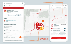
Live Link not only seamlessly works alongside the Causeway one.network Traffic Management module, but the intuitive Live Link app, designed specifically for teams out in the field, allows lanes and roads to be closed directly from the roadside.
Now, DCC use Live Link to close roads in all emergency situations – from floods, to fallen trees, to disruptive road collisions.
If a vehicle crashes and requires a lane or road closure, Derbyshire Police now contacts the DCC control room. The team uses Live Link to close the road, sending this vital information to navigation providers in real time. This allows GPS apps to alert drivers to incidents and redirect them. The outcome: enhanced visibility of road closures, aiding in the safety of drivers and emergency responders throughout Derbyshire.
Not long ago, there was a flood at Tissington Ford. A car driving through the area got stuck in the flood. Thanks to Live Link, handling this situation was much easier than before. We could easily block the road using the mobile app, and this update was instantly shown on navigation apps.
– James Adams, Traffic Manager, Derbyshire County Council
Live Link also proved especially helpful during the recent devastation of Storm Babet in October 2023, when a large part of the Derbyshire network was impassable.
The ability to close and reopen roads through Live Link has been transformative for DCC, empowering them to impact driver behavior and assist drivers in navigating around the county more easily.
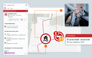
Live Link is just one method Derbyshire uses to communicate their closures and street works. The council is now also working with councilors, getting them trained to use Causeway one.network and its email alert functionality to keep residents up to date about all road events in their area.
Key Outcomes
- Greater impact on driver behavior by instantly issuing crucial road closure updates to major navigation apps.
- Improved ability to quickly take action on road and lane closures during incidents or severe weather events.
- Enhanced visibility of road closures throughout Derbyshire to help keep drivers and emergency responders safe.
For more information on how Causeway one.network & Live Link can help you keep drivers safe and improve journeys on your roadways, get in touch.


