Route Manager
Manage road disruptions and bus route clashes with ease.
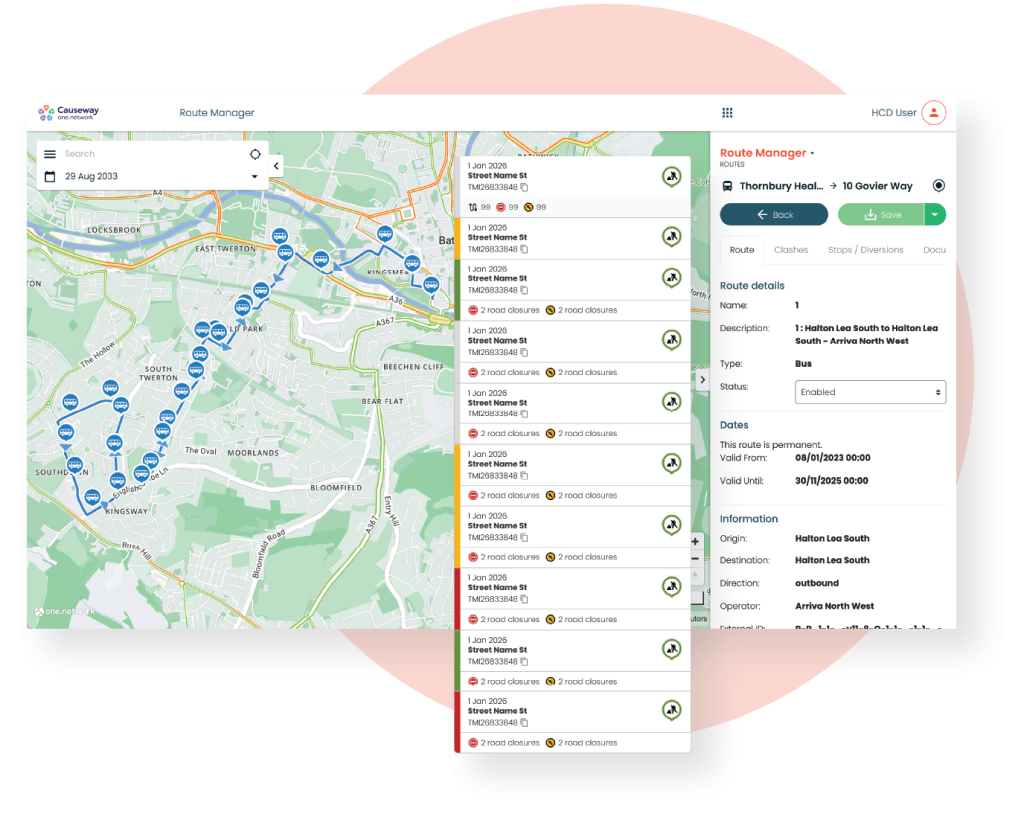
Route Manager is a powerful, collaborative map-based tool designed to connect highway authorities and transport operators. By providing a comprehensive view of your road network, Route Manager helps minimize the impact of roadworks on bus routes and other critical infrastructure. Our platform allows agencies to proactively manage disruptions, ensuring smoother operations and improved communication with stakeholders. As a key module within the one.network platform, Route Manager is set to revolutionize transportation management across the United States.
Why Use Route Manager?
Seamlessly communicate and proactively plan bus routes across state, county, and city roadways for optimal efficiency.

Proactive Clash Management
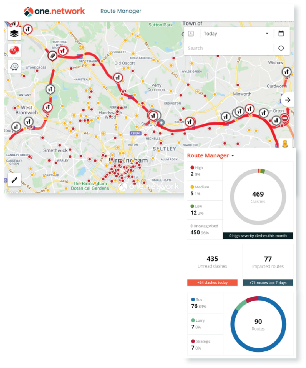
Identify and resolve potential clashes between roadworks, bus routes, and underground assets during the planning phase. This foresight reduces disruptions and ensures a more efficient workflow for transportation teams.

Improved Communication and Collaboration
Route Manager facilitates seamless communication between ROW teams, transport teams, and bus operators. With a shared, real-time view of the road network, all parties can collaborate effectively to address potential conflicts and optimize route management.
Reduced Delays and Disruptions
By proactively managing the impact of roadworks, Route Manager helps minimize delays and disruptions to bus services. This ensures that transport operators can maintain schedules and deliver a reliable service to passengers, even in the face of ongoing roadworks.
Key features
Real-Time Visibility
Stay Ahead with Real-Time Route Insights for Smarter, Faster Decisions
Built-In Communication Tools
Streamline Communication for Coordinated, Impact-Free Transportation
Intelligent Planning and Diversion Management
Proactively Resolve Route Conflicts to Keep Transportation Flowing Smoothly
Related customer stories
Plan Share
Unified permitting workflows between road agencies, contractors, and the public
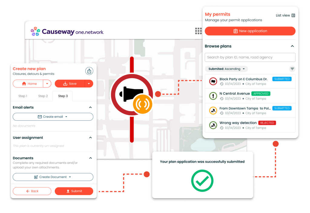
Plan Share transforms permit management into a seamless, map-based experience, streamlining the way you plan and manage disruption on your road network. Ditch the spreadsheets and PDFs for a collaborative platform that delivers transparency, efficiency, and safety across all teams trusted with managing your right of way.
Why use Plan Share?
Save time and improve public engagement with geospatial permitting and project planning

Do more with less
Manage your incoming applications more effectively by spotting planning conflicts and opportunities upfront – saving you time and money on your projects.

Improve public trust
Bring your teams together under the same operational view. Work more effectively with key stakeholders, partners and the public to deliver more efficient use of the road network.

Get the word out
Communicate permits and projects visually on our public map and make your data available to drivers via nav partners thanks to seamless workflows that save you time getting the word out.
Key features
GIS Permitting Portal
Receive accurate geospatial data with every application
Embed our permitting portal into your agency’s website to provide your applicants with an intuitive, map-based submission process.
Applicants submit their applications with GIS data, including location and traffic control measures–meaning less data entry is required for the road agency.

Seamless Approval Workflows
Reduce admin costs and improve decision-making
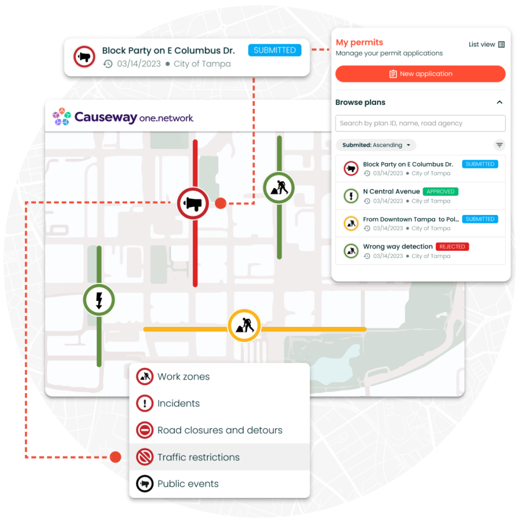
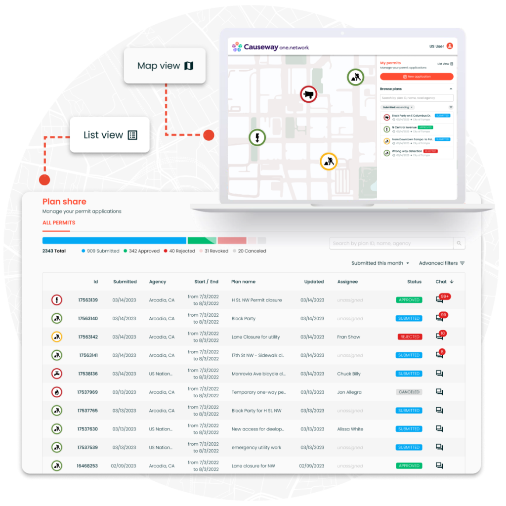
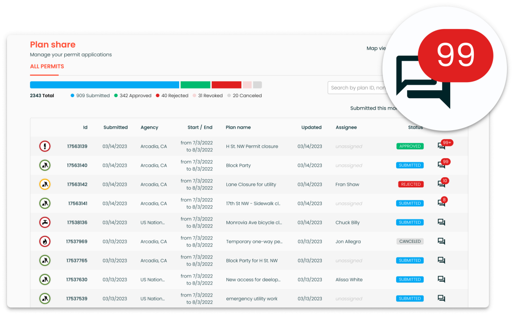
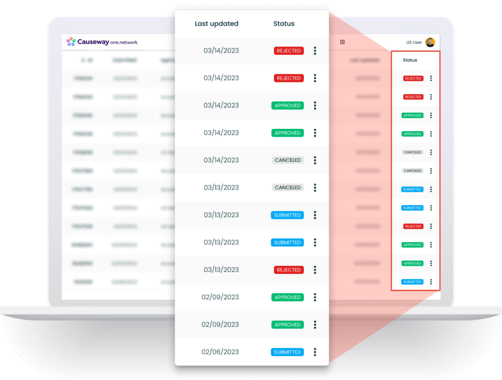
Easily group permits by application status, applicant, or other custom filters, so that you always know which permits require immediate attention.
Customize your internal workflows by assigning internal users or teams to specific permits, whilst also ensuring organization-wide visibility of all projects.
Single Operational View
Boost collaboration and efficiency across teams
Causeway one.network centralizes all of your road event data on our map, by integrating with your existing right of way systems and APIs.
Applicants and internal approvers will see how applications affect other planned road events, leading to more efficient project planning and delivery.

More features
Live Chat
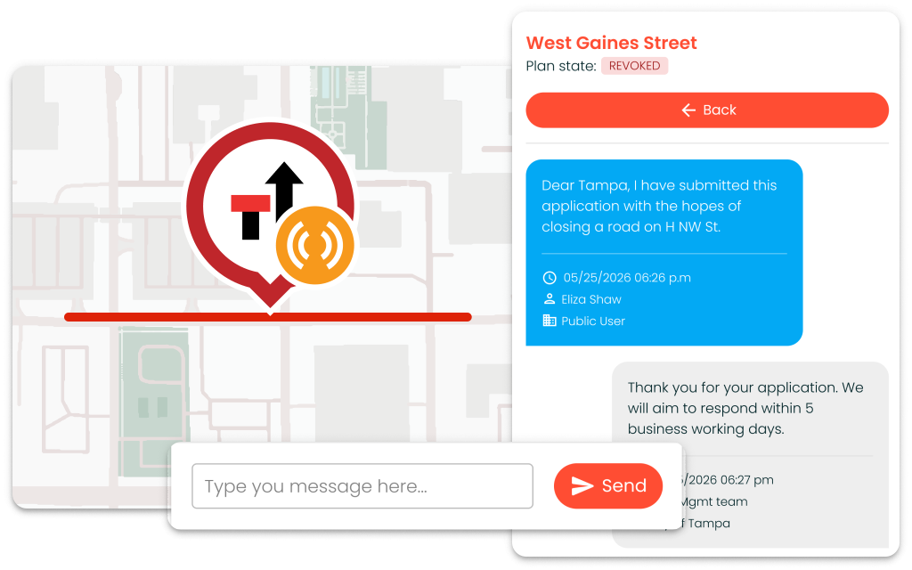
Resolve issues with applicants faster
Ditch the emails and chat with your applicants directly within Plan Share, which automatically generates an archive of all communication between both parties over time.
Email Notifications
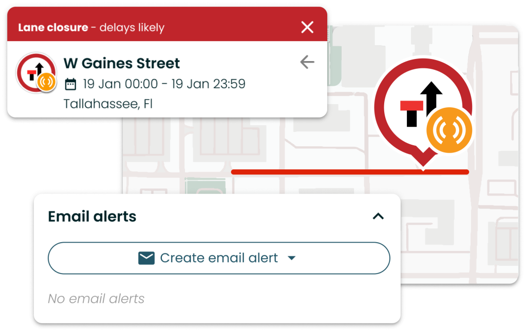
Automated project updates keep all parties in the know
Applicants and approvers receive updates whenever there are major updates to applications, prompting users to resolve issues as they arise and improves processing times.
Seamless Communications
Platform-enabled comms and data integrations
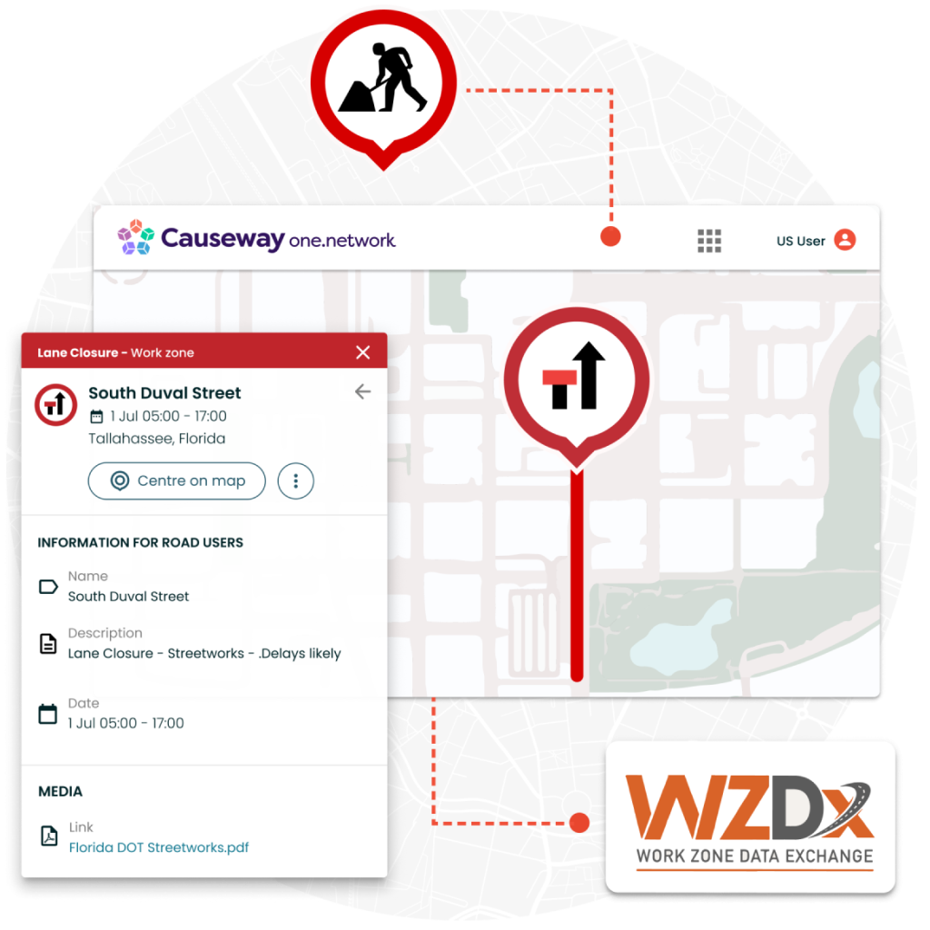
Once permits are approved, plans can be published publicly, automatically sharing this permit and its associated plans via our public map and WZDx feeds that push to nav-apps.
Related customer stories

Traffic Management
Unified work zone and ROW management that drives operational efficiency across teams
Traffic Management is an intuitive tool that has transformed how road agencies and contractors plan, coordinate and communicate any right of way intervention, from work zones to sporting events. The collaborative map-based interface streamlines workflows and enables crystal clear communication between stakeholders, and ultimately the public.
Why use Traffic Management?
Unburden your teams with digital workflows that save time and create industry-leading data
Enhance data to improve usability
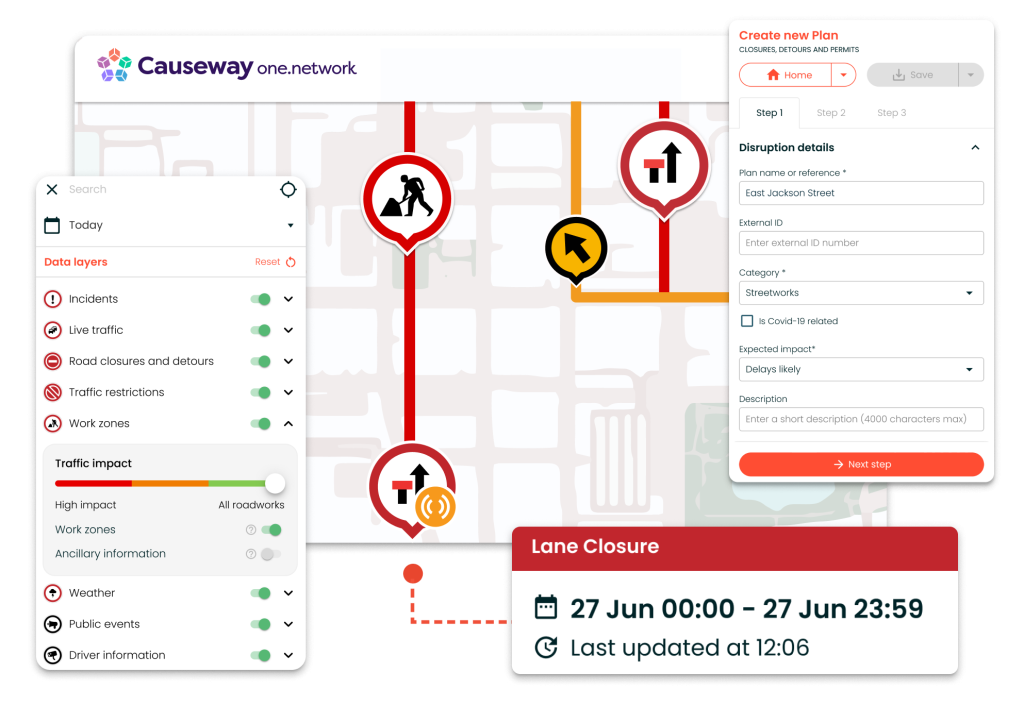
Input, aggregate and enhance all work zones, permits, events and maintenance of traffic plans within a single operational view that reflects changes to the public instantly.
Standardize and automate workflows
Unlock capacity across teams with standardized application processes, documentation templates and automated stakeholder communications .
Influence journeys to boost safety
Traffic Management enables agencies to seamlessly curate road event data, maintain high-quality WZDx feeds and directly integrate with Google Maps, Apple Maps, Waze, TomTom and Here.
Key features
Digital Enablement
Increase efficiency through better collaboration
- Transform coordination with a single, intuitive map-based interface that aggregates and enhances all road incidents, work zones, events and MOT plans.
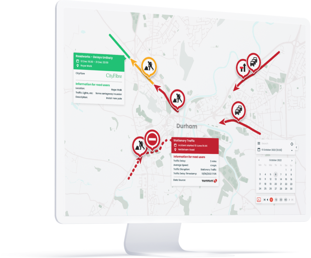
- Visualize historic, real-time and planned work zones, events and MOT plans to better manage disruption on the network.
- Enable seamless cross-jurisdictional collaboration through the public-facing map and real-time Open APIs configured for WZDx and all leading navigation-apps.
Seamless Communication
Improve public and stakeholder engagement
- Ensure accurate work zone information and MOT plans are instantly communicated to the public and key stakeholders.
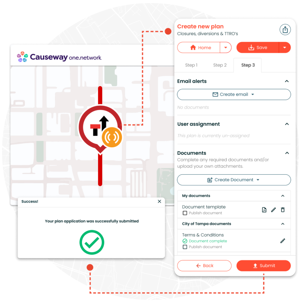
- Automate stakeholder documentation creation and email alerts to save time and improve visibility.
- Help the public better understand what is happening on your network and who is responsible.

Smarter Coordination
Reduce disruption and unnecessary congestion
- Better plan works and mitigate the impact of interventions through a single operational view of all historical, active and planned works on the network.
- More easily collaborate with neighboring agencies to avoid clashes and reduce the likelihood of unexpected congestion hotspots.
- Contribute to sustainability and Vision Zero objectives by providing the road event data that underpins better planning, communication and safety initiatives.

More features
Live Link
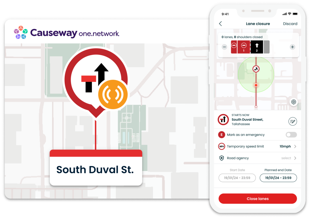
Communicate closures to drivers via nav-apps
Improve journeys and road safety by integrating Live Link and push real-time lane and road closure information directly to navigation apps.
Plan Share
Integrate and simplify permitting workflows
The Plan Share module streamlines permit management for your supply chain and the public, with intuitive map-based experiences and dashboards that save time and money.

Event Management
Manage and communicate disruption seamlessly
Use Traffic Management to transform the planning, coordination and communication of disruption on your network caused by major events; from game days to marathons.
Related customer stories


